OSINT · Investigation
Chasing the Shadow Fleet: A Beginner-Friendly Maritime OSINT Investigation
⚡ Quick Case Overview (AI Overview Summary)
The Interception
The tanker Smyrtos (IMO 9389100) was boarded by UK Royal Marine Commandos in the English Channel on June 14, 2026, suspected of carrying sanctioned Russian oil.
Sanctions Registry
OpenSanctions records confirm designations by the EU, UK, Switzerland, Canada, and Ukraine between July 2025 and February 2026.
Ownership Timeline
Transitioned from Daira Shipping (Seychelles) to Zhao Yao Shipping (Hong Kong) in Sept 2025. Technical management was listed as "Unknown" by May 2026.
Legal Status
Captain Ajay Pant was charged by the UK Crown Prosecution Service on June 15, 2026, for sanctions breaches. He is presumed innocent until proven guilty.
⚠ Legal disclaimer & boundaries
This case study is an educational OSINT walkthrough. All ownership, flag, and sanctions facts are sourced to named public registries and official databases. Ajay Pant has been charged, not convicted; he is legally presumed innocent. Corporate entities are named because they appear in public records. Snapshots are correct as of July 12, 2026, and do not constitute legal or financial advice.
On June 14, 2026, a headline moved quickly across international news: UK Royal Marine Commandos had boarded a tanker in the English Channel. The ship was the Smyrtos, and the UK Ministry of Defence described the operation as the first UK-led interdiction of its kind against a vessel suspected of belonging to Russia's sanctions-busting shadow fleet.
This case study reconstructs that story using only free, publicly accessible tools, cross-checking every claim against at least one independent source. Screenshots taken during this research are integrated directly inside this walkthrough as a numbered evidence log (Image 1 through Image 20) with every visible data point transcribed.
Below is the complete step-by-step ship tracking workflow that a beginner can use to replicate this investigation for free.
Step 1: Starting From the News (Primary Reporting)
Every open-source investigation starts with a spark of primary reporting. In this case, international news coverage and official government announcements provided the core anchor facts: vessel name, location, and legal action.
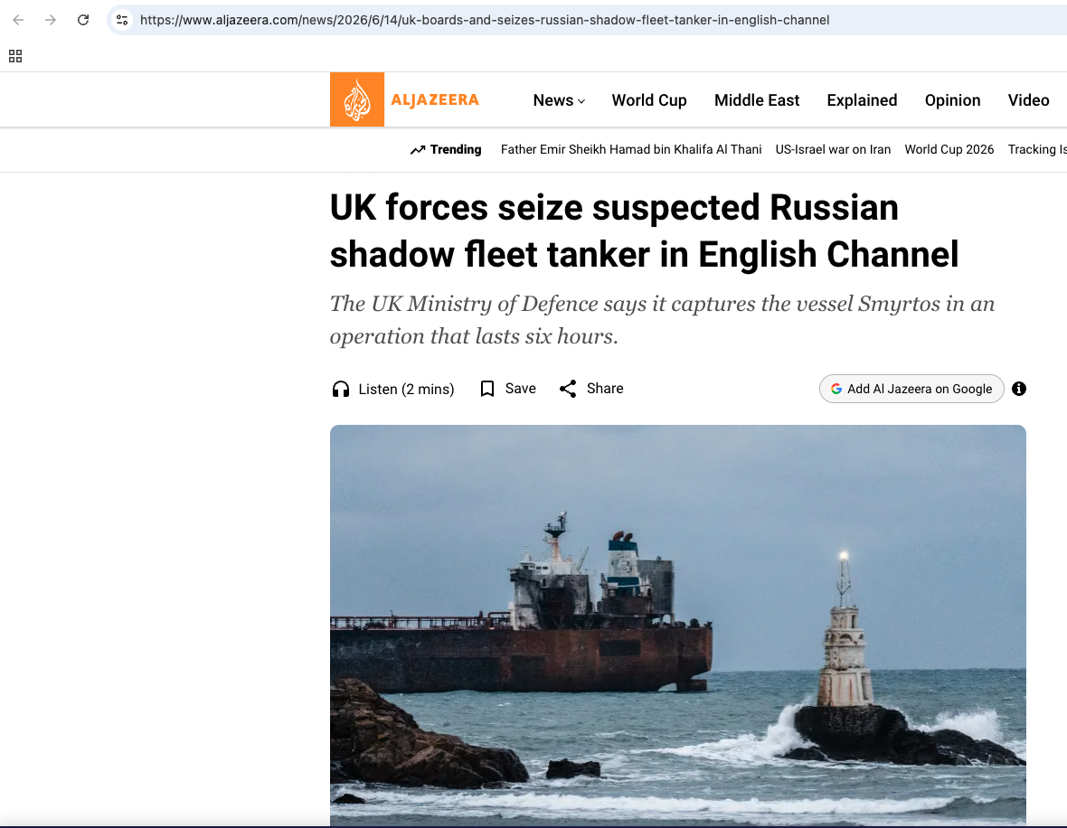 Image 20: Al Jazeera reporting on June 14, 2026, announcing the interception of the Smyrtos by UK Royal Marine Commandos in the English Channel. Actual report: Al Jazeera News
To cross-reference the news reporting, the UK Prime Minister's office released a public statement confirming that the operation was directly sanctioned under national security provisions. Public reaction was immediate, indicating high visibility for the operation.
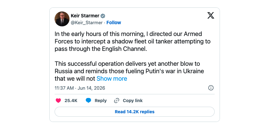 Image 19: Official statement on X by Prime Minister Keir Starmer, confirming he directed the armed forces to intercept the vessel. Actual post: Keir Starmer Profile
By June 15, 2026, the case escalated from an operational security event to a formal criminal prosecution. The UK Crown Prosecution Service (CPS) announced official charges against the ship's master, bringing the incident into the legal system.
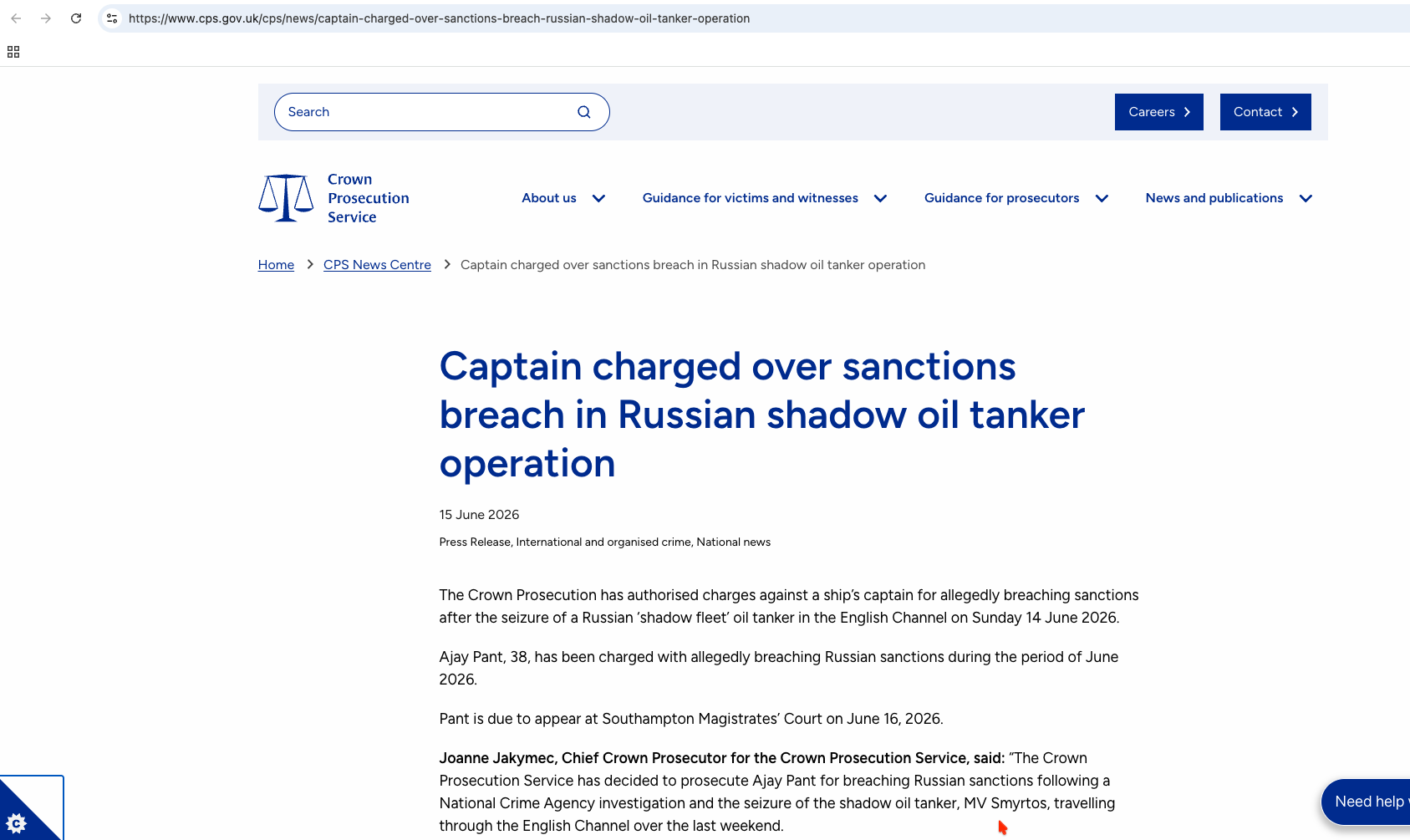 Image 18: CPS press release confirming Captain Ajay Pant was charged following a National Crime Agency (NCA) investigation. Actual release: CPS Release
At this stage, we have established a baseline of facts: the ship is the MV Smyrtos, the captain is Ajay Pant, and the charging authority is the UK Crown Prosecution Service. Now we begin the OSINT lookup steps to verify the ship's underlying records.
Step 2: Establishing the Ship's Identity (Google and VesselFinder)
A ship's name can be painted over or changed in days. To track a vessel reliably, beginners must locate its permanent identifiers: the IMO (International Maritime Organization) Number and the MMSI (Maritime Mobile Service Identity). An initial search query was used to grab these identifiers from indexing engines.
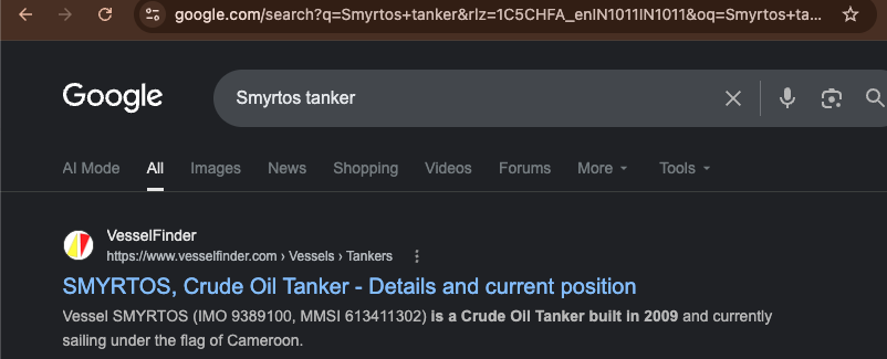 Image 17: Initial Google search query page showing VesselFinder listings index details. Actual query: Google Search Lookup
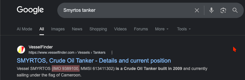 Image 16: Snippet search result highlighting the vessel's key specs: IMO 9389100, MMSI 613411302, and Cameroon flag status.
With the IMO number (9389100) in hand, we cross-referenced the global VesselFinder database to check the vessel's current registered identity. This confirmed that the IMO points exclusively to the Smyrtos, a Crude Oil Tanker built in 2009 with a gross tonnage of 58,667 tonnes.
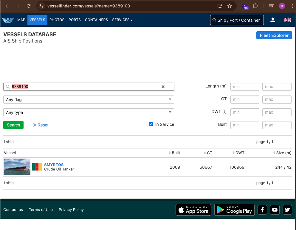 Image 11: VesselFinder database search query confirming the IMO anchors a single matching vessel: SMYRTOS. Actual database search: VesselFinder Search
Step 3: Checking the Sanctions Claim (OpenSanctions)
To verify the MoD's claim that the Smyrtos was a sanctioned entity, we ran the IMO through OpenSanctions, a public database that aggregates sanctions lists across multiple jurisdictions.
The query returned a highly comprehensive profile showing that the vessel is flagged across at least six major sanctions datasets. The specs match our VesselFinder search:
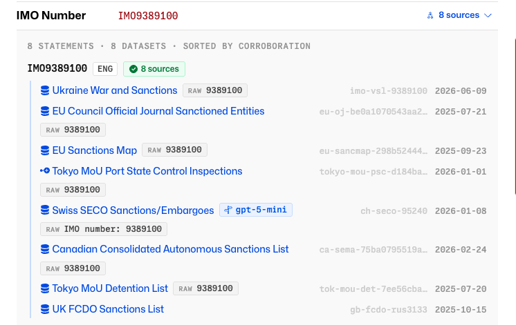 Image 6: OpenSanctions specs overview listing vessel gross registered tonnage, MMSI details, and alternate flag histories. Actual profile: OpenSanctions Record
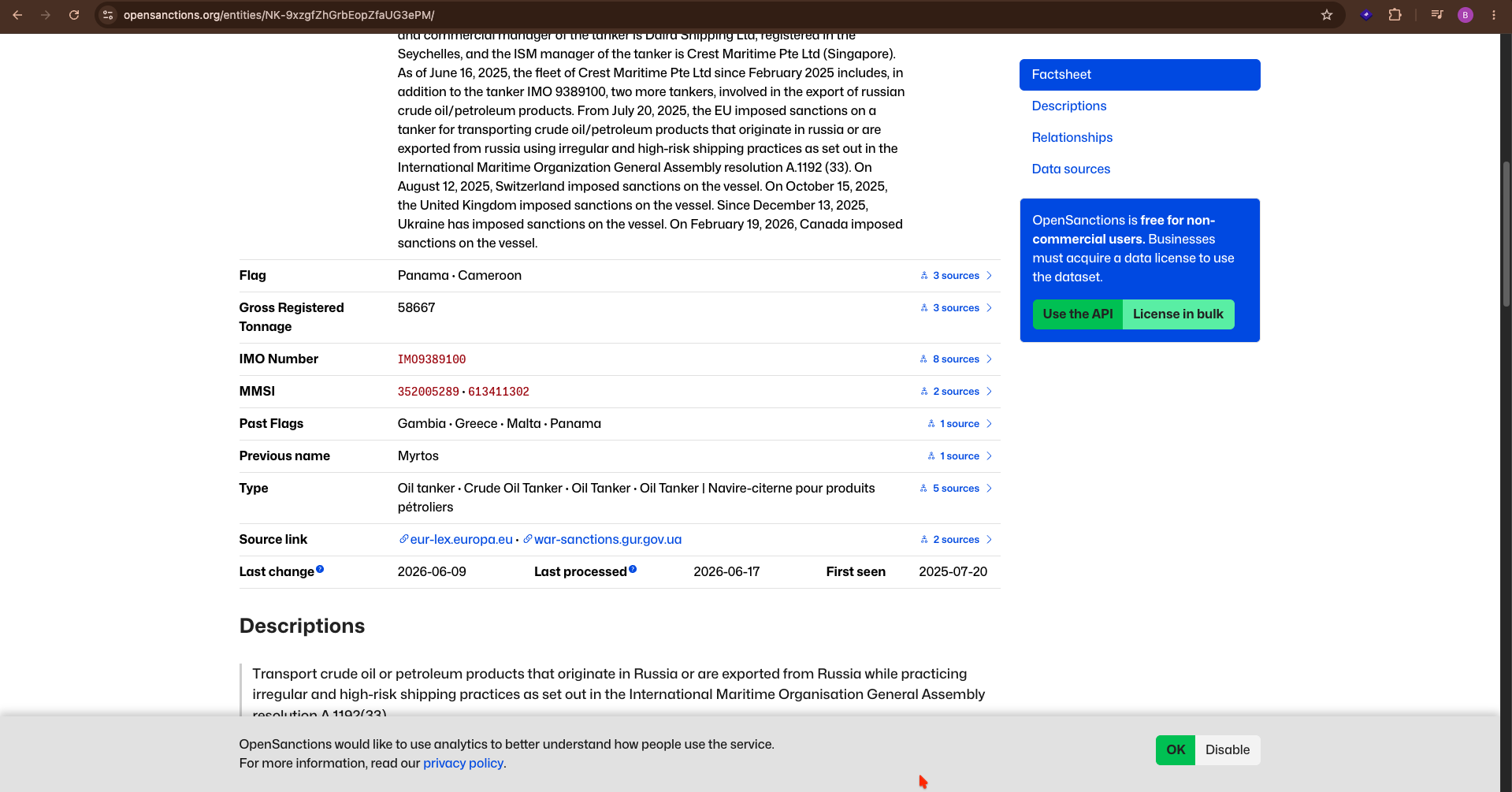 Image 8: OpenSanctions historical flag indicators showing previous registries including Panama, Malta, Greece, and Gambia.
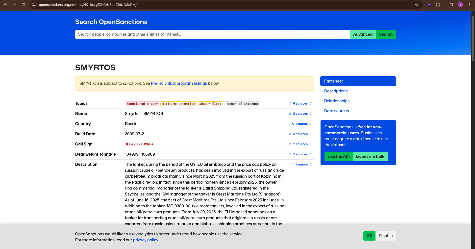 Image 9: Narrative timeline pulled from public database detailing the ship's Russian oil transit runs from Kozmino.
The sanctions tags show designations spanning multiple international regulatory bodies. This indicates that the vessel has been systematically blacklisted globally rather than facing a single national embargo.
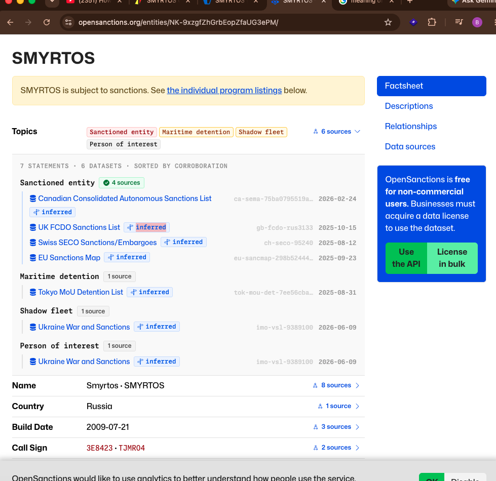 Image 7: List of sanctions topics in OpenSanctions: Canada Consolidated Sanctions, UK FCDO, Switzerland SECO, and EU Sanctions Map.
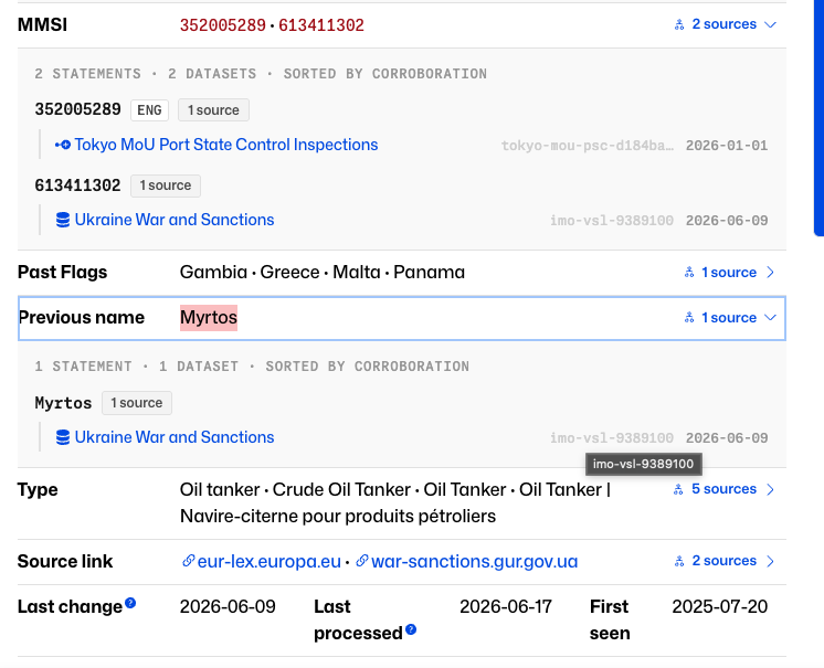 Image 5: Chronology of sanctions: EU (July 2025), Switzerland (Aug 2025), UK (Oct 2025), Ukraine (Dec 2025), Canada (Feb 2026).
Free Sanctions Tools:
OpenSanctions
Step 4: Checking Live Tracking Data (VesselFinder vs MarineTraffic)
To verify the ship's recent voyages and current status, we cross-referenced AIS (Automatic Identification System) tracking data across two independent, free-tier platforms: VesselFinder and MarineTraffic.
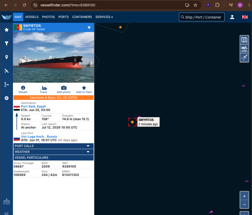 Image 10: VesselFinder details showing the ship's status as 'At anchor' off the UK coast, with its last port listed as Ust-Luga, Russia. Actual details page: VesselFinder Details
Next, we queried MarineTraffic to verify these parameters. Both platforms agreed on the vessel's current "At anchor" status, draught (14.6 meters), and heading (158-159 degrees), but revealed a slight mismatch on the departure timestamp from Russia.
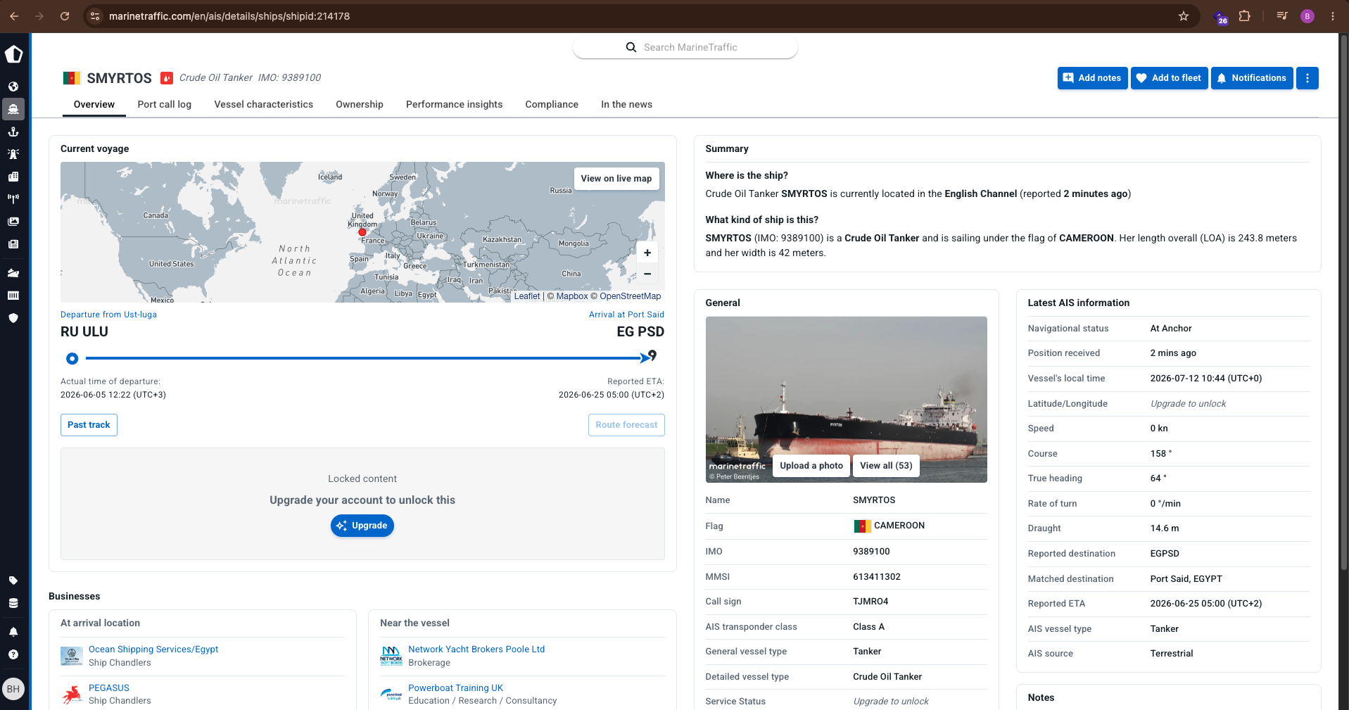 Image 13: MarineTraffic specifications page showing Cameroon registry flag, Terrestrial AIS source, and destination Port Said, Egypt. Actual details page: MarineTraffic Details
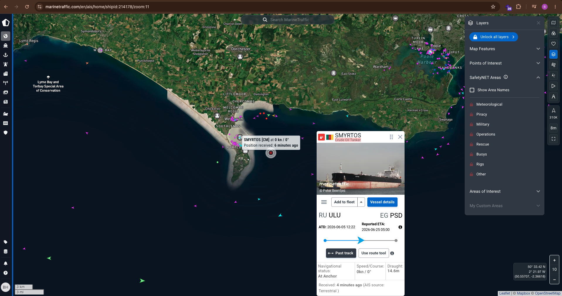 Image 4: MarineTraffic card showing the voyage route: RU ULU (Ust-Luga) to EG PSD (Port Said), departing on June 5, 2026.
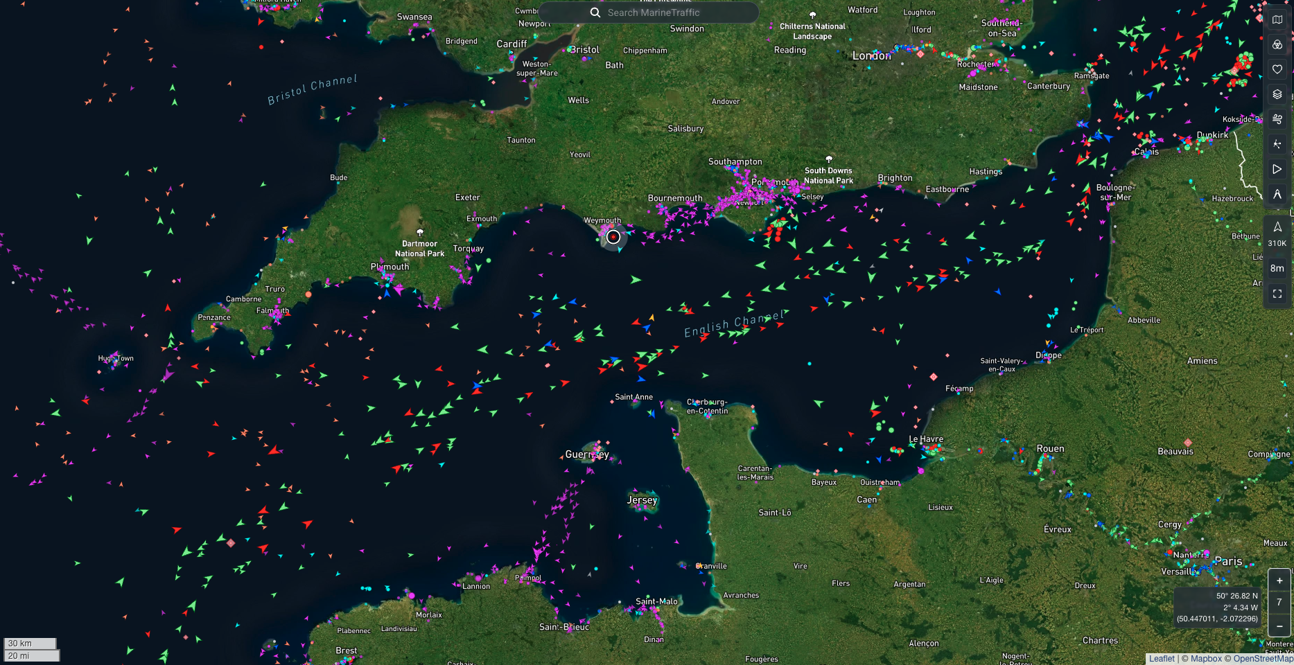
We verified the map telemetry views to pinpoint the exact location in the English Channel off the Dorset/Weymouth coast where the vessel has remained stationary since its boarding.
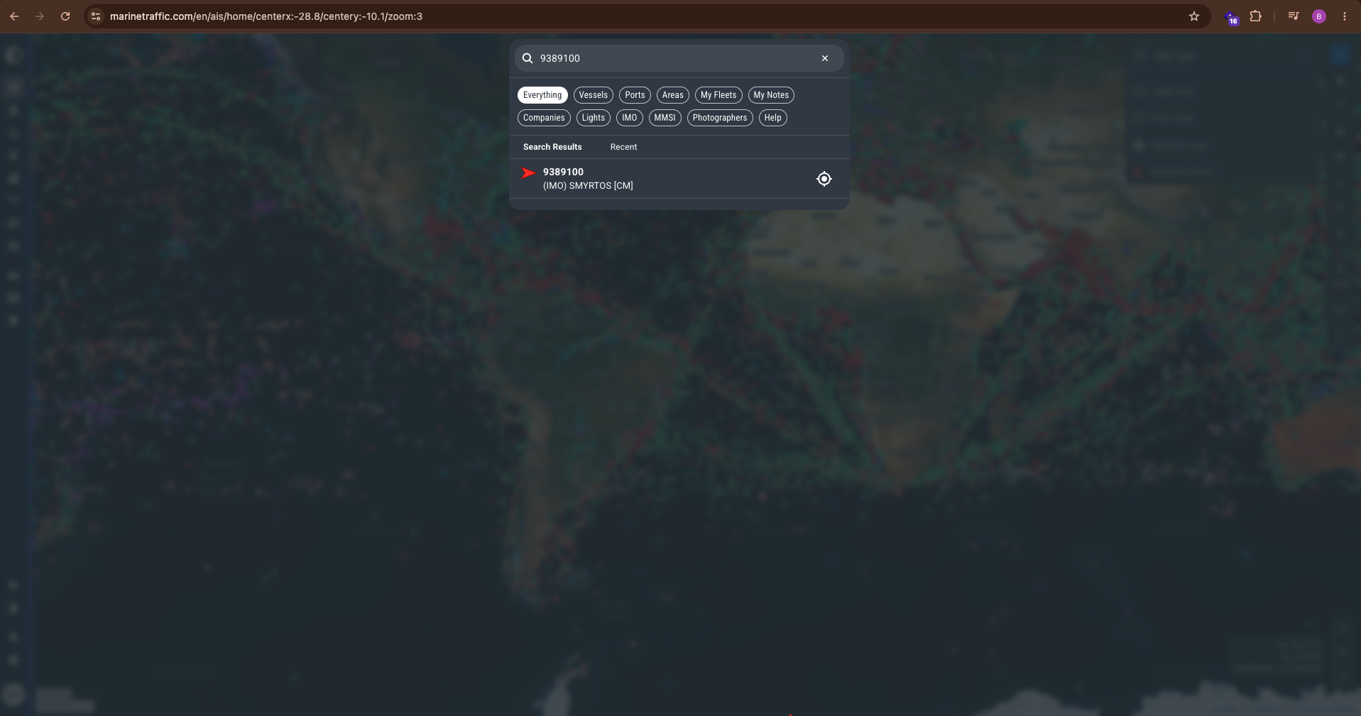 Image 12: Map overview showing the anchorage position offshore from Weymouth and Portland, UK.
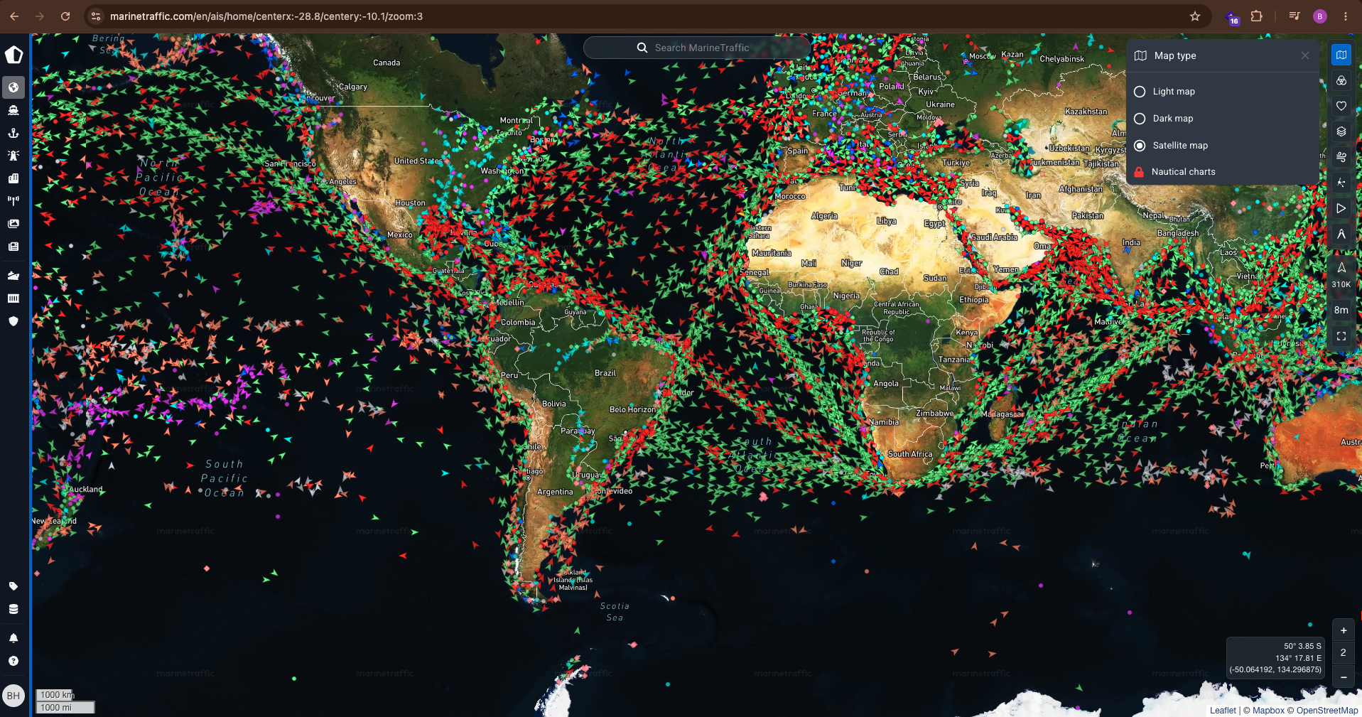 Image 14: Search match showing IMO 9389100 mapped to the Cameroon flag vessel.
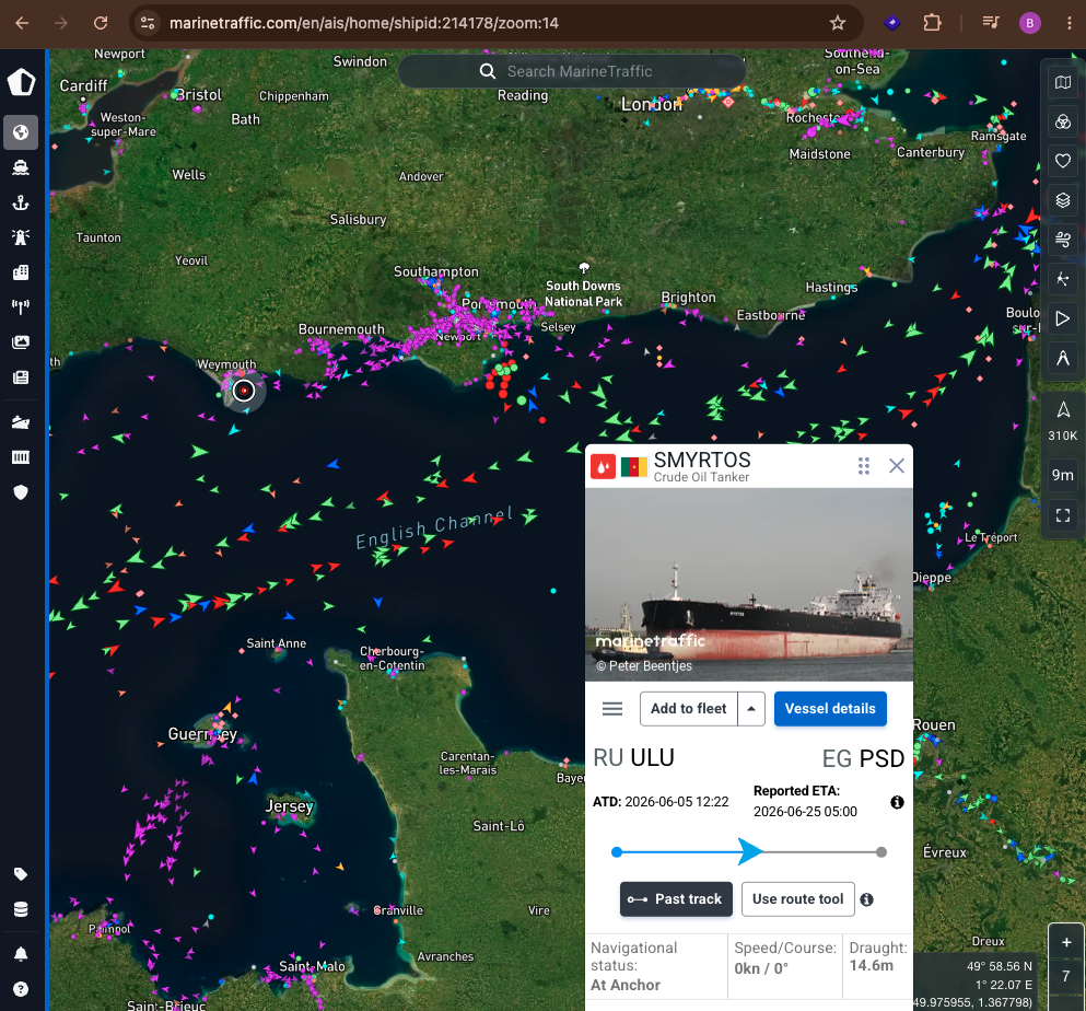 Image 15: Map configuration view showing the active satellite tracking selector options.
The Telemetry Discrepancy: VesselFinder recorded the departure from Ust-Luga, Russia, on June 1, 19:07 UTC. MarineTraffic recorded it on June 5, 12:22 UTC. This four-day variance is typical in OSINT work and usually indicates differing reporting endpoints (port berth vs. anchorage bounds) or temporary AIS sensor gaps. It does not alter the fact that the vessel departed Russia in early June bound for Egypt, but was detained mid-voyage.
Step 5: Following the Ownership Chain (Equasis)
Operating in a shadow fleet requires layers of corporate management. To map this, we consulted Equasis, a public vessel registry database co-managed by several maritime administrations. Equasis requires a free account to log in, representing one of the best sources for ship manager research.
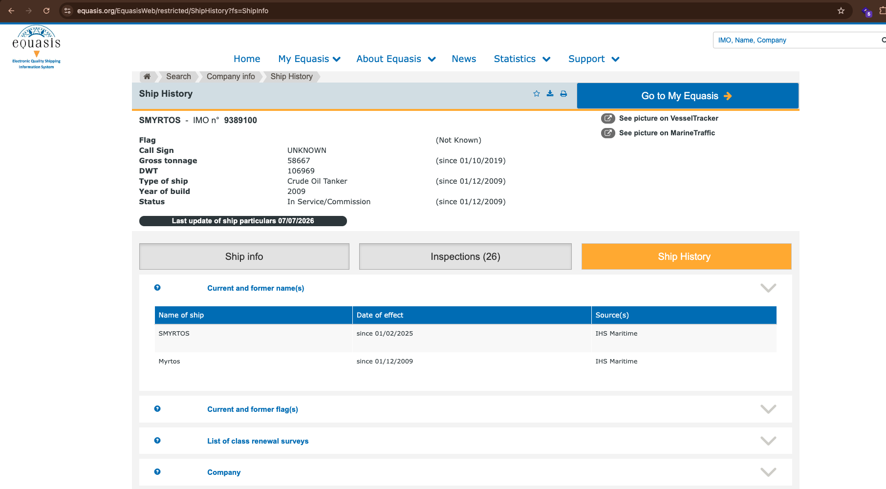 Image 2: Equasis Management Detail showing registered owner and commercial manager as Zhao Yao Shipping Ltd (Hong Kong). Info portal: Equasis Ship Search
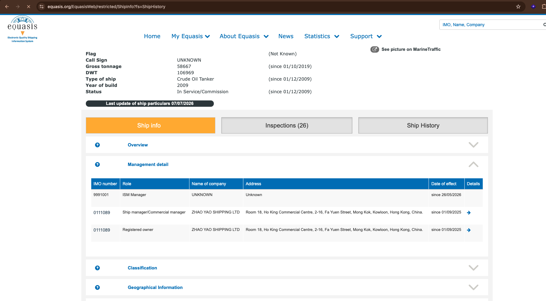 Image 3: Equasis Ship History showing name changes, confirming the transition from 'Myrtos' to 'Smyrtos' in February 2025.
The Corporate Timeline:
- Feb 2025: Ownership and commercial management held by Daira Shipping Ltd (Seychelles), with technical (ISM) management under Crest Maritime Pte Ltd (Singapore), as listed in the OpenSanctions narrative.
- Sept 2025: Registered owner and commercial manager shifted to Zhao Yao Shipping Ltd, operating out of a shared commercial address in Mong Kok, Hong Kong, according to Equasis.
- May 2026: The technical (ISM) manager in Equasis was updated to "UNKNOWN," indicating the ship's operational oversight records were decoupled weeks before the Channel boarding.
Free Ownership Registry:
Equasis
Step 6: Attempting Satellite Confirmation (Copernicus Sentinel-2)
Finally, we used the free Copernicus Browser to view Sentinel-2 satellite imagery of the Weymouth/Portland anchorage area from a July 9, 2026 pass, aiming to visually confirm the vessel's presence.
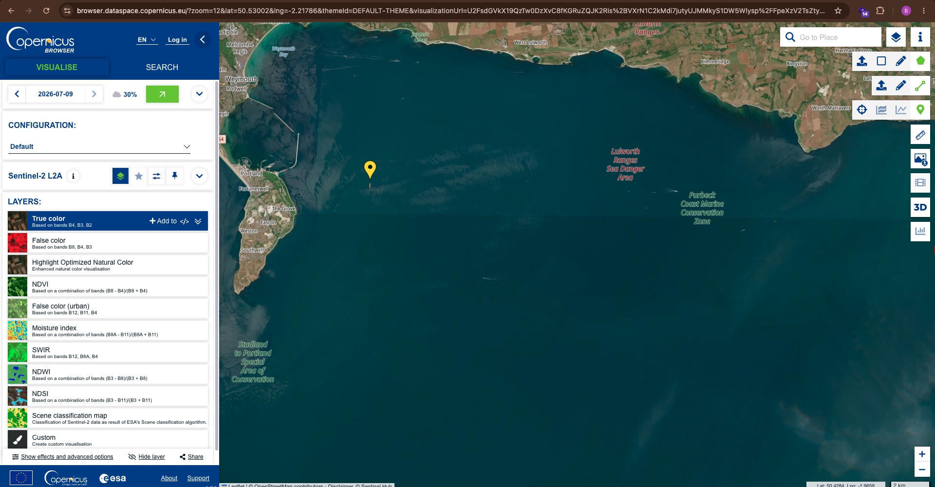 Image 1: Sentinel-2 true-color image of Weymouth Bay, showing general coastal geography and marine conservation bounds. Map browser link: Copernicus Browser Dataspace
A Lesson in OSINT Limits: Sentinel-2 visual bands operate at a resolution of 10 meters per pixel. At this scale, a 244-meter ship appears only as a tiny cluster of pixels. While we can see the anchorage coordinates and confirm the coastal zone was clear of heavy cloud cover, we cannot resolve the ship's physical hull details or name. Acknowledge this limitation: free-tier satellite data is excellent for macro-analysis, but tasked commercial high-res radar or optical satellite services are required for positive visual identification.
Free Satellite Maps:
Copernicus Dataspace
Complete Evidence Log
This table maps all 20 images referenced in this case study, matching each database claim to its corresponding screenshot asset in the repository:
| Image | Source Platform | Evidence Description & Filename |
|---|---|---|
| Image 1 | Copernicus Browser | Sentinel-2 L2A imagery near Weymouth (copernicus-sentinel-coastline.png) |
| Image 2 | Equasis Ship Info | Hong Kong owner / ISM Manager detail table (equasis-management-detail.png) |
| Image 3 | Equasis Ship History | Vessel name transition particulars list (equasis-ship-history.png) |
| Image 4 | MarineTraffic Map | Telemetric popup showing June 5 departure timestamp (marinetraffic-map-popup.png) |
| Image 5 | OpenSanctions | Chronological breakdown narrative of sanctions list dates (opensanctions-description-timeline.png) |
| Image 6 | OpenSanctions | Vessel specifications details page overview (opensanctions-vessel-details.png) |
| Image 7 | OpenSanctions | Sanctions topics registry matches listing (opensanctions-topics-list.png) |
| Image 8 | OpenSanctions | Identified flag history including Panama, Malta, Greece (opensanctions-specs-flag.png) |
| Image 9 | OpenSanctions | Kozmino port export narrative segment (opensanctions-narrative-part1.png) |
| Image 10 | VesselFinder | Vessel specs details and active sanctions status banners (vesselfinder-ship-details.png) |
| Image 11 | VesselFinder | Database query output for IMO 9389100 (vesselfinder-search-result.png) |
| Image 12 | MarineTraffic | Anchorage map layout of Weymouth Bay coordinates (marinetraffic-map-view.png) |
| Image 13 | MarineTraffic | General overview and registered AIS details (marinetraffic-vessel-details.png) |
| Image 14 | MarineTraffic | Database search result interface for IMO matching (marinetraffic-global-search.png) |
| Image 15 | MarineTraffic | Global fleet map configuration layout (marinetraffic-fleet-map.png) |
| Image 16 | Google Search | Search result snippet detailing Cameroon flag and MMSI (google-search-snippet.png) |
| Image 17 | Google Search | Full web search view for query 'Smyrtos tanker' (google-search-chrome.png) |
| Image 18 | CPS Press Release | Prosecution announcement details page (cps-captain-charged.png) |
| Image 19 | X (Twitter) | Prime Minister Keir Starmer statement card (prime-minister-statement.png) |
| Image 20 | Al Jazeera | News report headline and coverage photograph (al-jazeera-news-seizure.png) |
Key Findings Summary
| Investigative Question | Verified Data Points | Corroboration Sources |
|---|---|---|
| Permanent Identity | IMO 9389100, MMSI 613411302 (formerly 352005289) | VesselFinder, MarineTraffic, OpenSanctions |
| Sanctions Status | EU, UK, Switzerland, Canada, Ukraine lists matching IMO | OpenSanctions |
| Voyage History | Ust-Luga (Russia) to Port Said (Egypt); Interdicted in English Channel | VesselFinder, MarineTraffic, News Reports |
| Ownership / Mgmt | Daira Shipping (Seychelles) → Zhao Yao Shipping (Hong Kong) | OpenSanctions, Equasis |
| Flag Transitions | Greece → Malta → Gambia → Panama → Cameroon | OpenSanctions, Equasis |
| Legal Proceedings | Captain Ajay Pant charged on June 15, 2026 | Crown Prosecution Service Release |
Free Tools Directory
Below is the complete list of free tools used in this maritime OSINT investigation along with their live access links:
| Tool Name | Purpose in Investigation | Direct Access Link |
|---|---|---|
| Google Search | Initial lookup, news indexing, and finding registry snippets | https://www.google.com |
| VesselFinder | IMO lookup database, general specifications, and AIS coastal tracking | https://www.vesselfinder.com |
| MarineTraffic | Dual-source AIS tracking data, voyage route maps, and telemetry | https://www.marinetraffic.com |
| OpenSanctions | Checking entities and vessels against consolidated global sanctions lists | https://www.opensanctions.org |
| Equasis | Tracing corporate management timelines, registered owners, and address details | https://www.equasis.org |
| Copernicus Browser | Accessing Sentinel-2 visual bands satellite imagery passes of coastal areas | https://browser.dataspace.copernicus.eu |
Lessons Learned and Actionable Takeaways
- Anchor every investigation to the IMO number rather than the vessel name, which changes frequently.
- Cross-reference sanctions lists across jurisdictions using aggregators like OpenSanctions for comprehensive data.
- Ownership is a timeline. Map the historical sequence of commercial and technical entities to expose patterns.
- Acknowledge tracking discrepancies and tool limits, such as satellite resolution bounds and AIS timestamp offsets.
Frequently Asked Questions
-
What is the Smyrtos tanker?
The Smyrtos is a Crude Oil Tanker built in 2009 (IMO 9389100), boarded by UK Royal Marine Commandos in the English Channel on June 14, 2026, on suspicion of carrying sanctioned Russian oil.
-
Is the Smyrtos officially sanctioned?
Yes. Public OpenSanctions records tied to IMO 9389100 show designations from the EU, the UK, Switzerland, Ukraine, and Canada between July 2025 and February 2026.
-
Who owns the Smyrtos?
Ownership recorded in public registries changed over time. As of February 2025, Daira Shipping Ltd (Seychelles) was the owner and commercial manager, with Crest Maritime Pte Ltd (Singapore) as ISM manager. As of September 2025, Equasis records show Zhao Yao Shipping Ltd, a Hong Kong registered company, holding both the commercial management and registered ownership roles. As of May 2026, the ISM Manager field in Equasis shows "Unknown."
-
What happened to the ship's captain?
Captain Ajay Pant, 38, was charged by the UK Crown Prosecution Service on June 15, 2026, with breaching Russian sanctions. He is presumed innocent until proven guilty.
-
Can I verify any of this myself for free?
Yes. Every source used in this case study, including VesselFinder, MarineTraffic, OpenSanctions, Equasis, and the Copernicus Browser, offers free public access, and direct links are provided throughout this article.
-
Does this article accuse any country of wrongdoing?
No. This is an educational OSINT case study built entirely from information that governments, sanctions bodies, and news organizations have already made public. It is not a complaint, a legal filing, or an accusation beyond what those public sources already state.
Conclusion
The Smyrtos case shows that a real, breaking maritime news story can be independently verified, layer by layer, using entirely free and public tools. Starting from a single ship name in a headline, this investigation confirmed identity, sanctions status, voyage history, and a genuine two-stage ownership timeline, while staying transparent about the one place the evidence did not fully cooperate: satellite confirmation, and the one place two good sources simply disagreed: departure timestamps. That balance, verifying what can be verified and being honest about what cannot, is the core discipline of maritime OSINT.
Case Study Credit: Inspired by the outstanding maritime investigative workflows at Bendo Brown (YouTube) and the weekly threat intel briefs at The OSINT Newsletter. We highly recommend exploring their platforms to master advanced vessel tracking.